Chakrata in December: Build the Trip That Works Whether or Not It Snows
Most people book Chakrata in December for snow, and in two of the last three winters the first snow did not arrive until late January. Here is what the altitude actually does, which road closes when it does snow, and a four day plan that holds up either way.
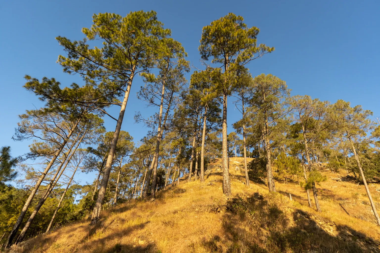
Chakrata gets booked in December for one reason, and almost everybody says it out loud: snow. It is the closest place to Delhi that sounds like it should be white in the last week of the year, it is nowhere near as crowded as Mussoorie, and the photographs circulating every winter are genuinely of deep snow on a deodar ridge.
The photographs are real. The timing is the problem.
In the 2023-24 winter, the first snowfall of the season at Chakrata was recorded on 31 January, after roughly two and a half months in which it had not rained or snowed anywhere in the state. In the 2025-26 winter, the first snowfall reached Chakrata, Mussoorie and Dhanaulti on 23 January, again after a long dry spell. In between, the 2024-25 winter behaved: by 23 December there had already been two snowfalls, and the high villages were under an inch of fresh snow.
Locally, November and December are still described as the normal months for the first snow, so it is fair to read those two late winters as a run of bad luck rather than the new rule. What they do establish is that a December date gives you no guarantee at all, and no booking, no operator and no forecast a month out can change that.
Which leaves you two options. Build a trip that is a disappointment unless it snows, or build one where snow is the bonus and the rest of it is worth the drive on its own. This guide is the second one. The altitudes, distances and seasons below come from the state tourism corporation and standard references, and the snow timeline comes from local reporting out of Dehradun, all of it linked as it appears.
What Chakrata actually is, and why that changes everything
This is not a hill station in the Mussoorie sense, and people who arrive expecting one spend the first evening confused.
Chakrata is a cantonment town, established in 1869 by the British Indian Army and still run as a military station. The Cantonment Board's ex officio President is the Army Station Commander, and its Chief Executive Officer is an Indian Defence Estates Service officer working under the Ministry of Defence. It is also the permanent garrison of the Special Frontier Force. The urban cantonment area covers under 16 square kilometres and had a population of about 5,100 at the 2011 census, roughly three quarters of it male, which tells you most of what you need to know about who lives there.
Practically, this means two things. Foreign passport holders face severe restrictions and should not assume they can simply drive up. Chakrata does not appear on the Ministry of Home Affairs list of Protected and Restricted Areas, which is the list that governs permits for Ladakh, Sikkim and the northeast, so there is no public online permit process to point you at. The restriction comes from the cantonment and the units based in it, and clearance is granted by the military authority rather than by a tourism office. Travel references commonly name the Special Frontier Force command as the authority to approach, but none of that is published on a government page you can rely on, so a foreign national should get permission confirmed in writing before committing to dates rather than trusting a blog that calls it routine. Indian citizens need no permit, though carrying photo ID is sensible in any cantonment.
The second thing is that there is no tourism machinery. The market is small, it shuts early, the cantonment is not a sightseeing zone, and the actual attractions sit 15 to 40 km out of town on mountain roads. Chakrata is where you sleep. It is not where you spend the day.
The town sits at 2,118 m in the Jaunsar-Bawar region, between the Tons and the Yamuna, in Dehradun district. Garhwal Mandal Vikas Nigam, the state tourism corporation, puts it 87 to 96 km from Dehradun depending on which line of its own page you read, and about 113 to 126 km from Jolly Grant airport. Mussoorie is roughly 73 km away. From Delhi it is a long single day, usually via Saharanpur, Vikasnagar and Kalsi.
The December snow question, answered with three winters
Rather than argue about averages, here is what local reporting from Dehradun actually recorded in each of the last three winters.
| Winter | When snow was reported | What the season looked like |
|---|---|---|
| 2023-24 | 31 January 2024, the season's first, at Lokhandi | No rain or snow anywhere in the state for about two and a half months before it |
| 2024-25 | 23 December 2024, already the season's second | About an inch lying at Chakrata, Lohari, Lokhandi, Moila, Devban and Koti Kanasar |
| 2025-26 | 23 January 2026 | First snow of the year across Mussoorie, Dhanaulti, Chakrata and the high temples, after a prolonged dry spell |
Why the state's own tourism corporation does not call December the best time
Worth noticing, because almost no blog mentions it. GMVN's own Chakrata page lists the best time to visit as March to May and October to November. December is not on that list.
That is not the state talking down its own winter. It is a sensible read of what the season does. October and November give you clear air, the long Himalayan views from the ridges, dry trails and open roads. December and January give you cold, short days, a real chance of nothing but brown grass, and an outside chance of the week that fills everybody's feed.
There is also a warming pattern underneath this that locals in the Jaunsar-Bawar orchards talk about more than tourists do. On 22 December 2024, Dehradun recorded a maximum of 24.5 degrees, four degrees above normal, and a minimum of 7.2 degrees, which local reporting noted was among the highest in recent years. Farmers and apple growers across these hills have spent several winters waiting on snow that arrived late or barely arrived.
The altitude ladder, and where snow lands first
If you understand one thing before booking, make it this. Chakrata town at 2,118 m is at the bottom of the interesting ground, not the top. Snow here behaves by altitude, and the state weather centre forecasts it by altitude too, in bands such as above 2,500 m rather than by district.
When snow did fall before Christmas in 2024, the places named in the reporting were Chakrata, Lohari, Lokhandi, Moila, Devban, which is the local spelling of Deoban, and Koti Kanasar. Those are not random villages. They are, almost exactly, the stops on any decent Chakrata itinerary.
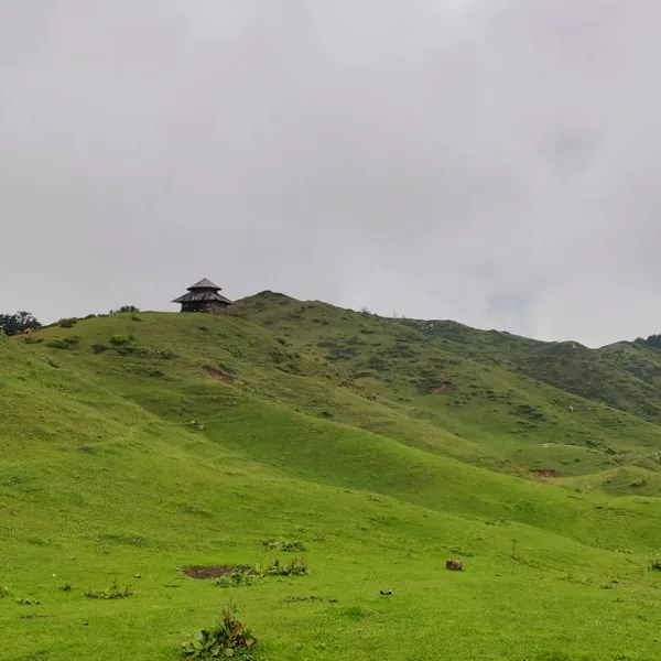
**Moila Top**, also called Moila Danda, is an alpine meadow at 2,699 m reached by a trek of about 3 km from the Budher Forest Rest House, which is itself around 30 km from Chakrata. A traditional wooden temple in the local Koti Banal style stands on the meadow, dedicated to the fairy goddesses the villages here call Pari Mata. On a clear morning the Garhwal peaks, Bandarpoonch and Swargarohini among them, line the horizon.
Deoban, the forest ridge whose name means the forest of the gods, is much closer to town at roughly 13 to 15 km, but it climbs from about 2,200 m up to 3,025 m, with Vyas Shikhar as its high point. Kharamba, the highest peak in the Chakrata area, is around 10,000 ft. Mundali, about 35 km out, has the slopes the state has long talked about as a ski area, higher again than Moila Top.
The practical upshot: in a marginal week, Chakrata town can be completely dry while Deoban and Moila are white. That is good news. It also means the snow is at the far end of the road, which is where the next problem starts.
Altitude chart drawn to scale showing Chakrata town at 2,118 metres well below Moila Top at 2,699 metres, the Mundali slopes at about 2,800 metres and the Deoban ridge at 3,025 metres, with a dashed line at 2,500 metres marking the altitude band above which the state weather centre forecasts snow
The road that decides your itinerary
The single stretch that governs a Chakrata winter trip is the Chakrata to Tyuni road, which is the way to Lokhandi, Koti Kanasar, Budher and the Moila trailhead.
On 25 December 2024, after the snow described above, about **4 km of that road, from Lokhandi towards Koti Kanasar, was blocked outright**. The national highways department put two JCBs and a snow cutter on it and was trying to reopen it by that afternoon. Villagers on the far side were cut off in the meantime.
This is the mechanic that ruins otherwise sensible plans. The snow you came for and the road to reach it are the same event. A heavy fall does not hand you a snowy meadow, it hands you a closed road and a day of waiting while machines clear it, followed by a surface that is fine for a local driver in a high clearance vehicle and genuinely unpleasant for a hatchback from Delhi with no experience of ice.
Three rules follow, and they are worth more than any packing list.
- Put the far end of the road early in the trip, not on the last morning. Moila Top and Budher on day two gives you a second attempt on day three. The same plan with Moila on the last day gives you nothing but a drive home.
- Do not self drive the upper stretches in fresh snow unless you have done it before. Hire a local driver with a vehicle that lives here. This is the one cost worth not saving.
- Keep one spare half day. If the road closes on the morning you were going up, it is usually open again within a day, and the difference between a trip that worked and one that did not is whether you had the hours to wait.
Tiger Falls: the five kilometre trek and the one kilometre version
Tiger Falls is the one Chakrata name most people already know, and the descriptions of how to reach it contradict each other in a way that catches visitors out.
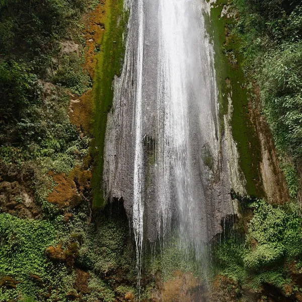
GMVN publishes it as 20 km from Chakrata with an easy 5 km trek in through rhododendron and oak, and the fall itself at about 312 ft, which the state describes as one of the highest in India. Elsewhere you will see it ranked among the highest direct waterfalls in Uttarakhand. Both are soft claims and 312 ft is nowhere near India's tallest, so take the height as the fact and the superlative as decoration.
In practice, a narrow paved road now runs much closer than it used to. Most vehicles park at a point above the fall and visitors walk down a steep final stretch of a kilometre or so, rather than doing the full forest trek. Both routes exist. The one you get depends on your driver and the state of the road, and in December the steep descent is the part to think about, because the spray ices the steps and the stone stays wet all day in shade.
Winter is not the fall at its most powerful. Volume is highest after the monsoon. What December gives you instead is a cold, quiet, often empty amphitheatre of rock and moss, which is a better photograph than a crowded one in October and a worse one than September's torrent.
Moila Top and the Budher caves, which are really one outing
These two get listed separately on every itinerary and they are, in practice, the same morning. The Budher Forest Rest House is the trailhead for both.
The walk up to the meadow is short, roughly 3 km, through deodar and kail so dense that the light goes green. It is a climb rather than a stroll, but it is not technical, and the ground opens out suddenly into a wide rolling bugyal with the little wooden temple on the high point and the Garhwal peaks lined up beyond. At 2,699 m you are high enough for it to be properly cold at the top in December and nowhere near high enough for altitude to be a concern.
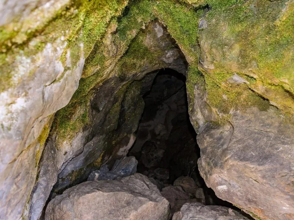
The Budher caves, sometimes called the Miola caves, sit at the edge of the same meadow. They are limestone, with stalactites and stalagmites, and local tradition ties them to the Pandavas, as it does half the caves and temples in this valley. Published descriptions put the main passage at around 150 m, though nobody with authority has posted a measured survey, so go in treating the length as a rough figure rather than a promise.
Two practical notes. The caves are unlit, so a head torch is not optional and a phone torch is a poor substitute when you want both hands. And the entrance and the floor stay slippery in winter, which is a reason to go in the morning rather than on the way back down in fading light.
What else is worth the drive
- Koti Kanasar, about 26 km out, where GMVN records a deodar with a girth of 6.35 m, described as the oldest and biggest in Asia. Even if you discount the superlative, standing under it explains why this forest is called the forest of the gods.
- Deoban, the ridge itself, which is the best Himalayan view in the area on a clear winter morning and the single most likely place to find snow when the town has none.
- Chilmiri Neck, the high point closest to town, with Bandarpoonch, Rohini and the Swargarohini group visible on a good day and good birdwatching in the forest around it.
- Kalsi, down on the Yamuna on the way in, where Ashoka's rock edict stands, its text in Pali. GMVN notes it is the only Ashokan rock edict in north India, which makes it an odd and excellent thing to stop at for twenty minutes on the drive up rather than skipping.
- Lakhamandal, an ancient Shiva temple complex in the same Jaunsar-Bawar region, protected by the Archaeological Survey of India. It is a long way out, so it belongs on a different trip or a very long day.
A four day plan that works with snow or without it
This is the shape that holds up in both outcomes. Three nights is the right length. Two nights means a lot of driving for one usable day, and four leaves you looking for things to do.
| Day | If the roads are clear | If it has just snowed |
|---|---|---|
| 1 | Delhi or Dehradun to Chakrata via Vikasnagar and Kalsi. Stop at the Ashokan rock edict. Arrive before dark. | Same, but leave earlier. The last 40 km is the slow part and you do not want it after sunset. |
| 2 | Drive out to Budher, trek the 3 km to Moila Top, see the caves, back by afternoon. | Check the Chakrata to Tyuni road before you leave. If it is being cleared, do Deoban and Chilmiri Neck instead and move Moila to day three. |
| 3 | Tiger Falls in the morning, Koti Kanasar deodars after, sunset from a ridge near town. | Second attempt at Moila Top now that the road has been cleared. Tiger Falls is lower and almost always reachable, so it is the fallback if it has not. |
| 4 | Chakrata back to Dehradun or Delhi, with a stop wherever you missed. | Leave earlier than you think you need to. Ice on the shaded upper bends holds until late morning. |
What people get wrong in December
- Underestimating the cold at the top. Chakrata town is cold. Moila Top, 600 m higher and exposed, is a different proposition in wind. Layers, a windproof outer, gloves and a cap, not a single heavy jacket.
- Forgetting how early it gets dark. Sunset here is before half past five in late December. A plan that has you starting a trek at two in the afternoon is a plan that finishes in the dark.
- Shoes. Trail shoes with real grip. The Moila trail, the Tiger Falls steps and the cave floor are all slippery, and the combination of frost and dry deodar needles is genuinely treacherous.
- Assuming you can top up on the way. Fuel, cash and anything you actually need should be sorted in Dehradun or Vikasnagar. The market in town is small and shuts early, and connectivity on the upper roads is patchy.
- Photographing freely in the cantonment. This is a working military station. Keep the camera on the forests, the meadows and the villages, and away from installations, gates and personnel.
- Expecting a hill station evening. There are no cafes to hop between and no nightlife. The evening is a bonfire, a shared meal and a very dark sky. If that sounds thin, this is the wrong destination for you and Mussoorie's Kempty and Landour day or Dhanaulti and Surkanda Devi will suit you better.
Doing it yourself, or going with a group
Self driving Chakrata is entirely doable in clear conditions and genuinely awkward in snow. The things that go wrong are not exotic: a car with no grip on an iced bend, a closed stretch of road with no local number to call, an unlit cave with one phone torch between four people, and a trailhead 30 km from your hotel with no transport back if your plan changes. That gap between the attraction and the logistics is the same one we wrote about in why booking travel experiences in India is still hard, and it is sharper in winter than at any other time of year.
If you would rather not solve it yourself, there is a group trip going up on exactly these dates. Chakrata and Moila Top with Samiksha runs 3 to 6 December 2026, Delhi to Delhi, with a small group, and the itinerary is built around the Moila Top trek, the Budher caves and Tiger Falls, with the host there for the whole four days. A hosted group also solves the two things solo travellers struggle with here, which are local drivers who know which road is open and somebody who has already decided what to do when it is not.
If your dates do not line up, the other upcoming group trips include Bir, Rajgundha and Barot in Himachal in November, where the same weather window logic applies to paragliding rather than snow. Our guide to booking a Bir Billing flight around the weather covers it, and the season by season guide to travelling in India covers where else December actually works.
Common questions
Does it snow in Chakrata in December? Sometimes. In the 2024-25 winter there was snow lying before Christmas. In the two winters on either side of it, the first snowfall did not arrive until late January. Plan for a cold, dry, beautiful forest trip and treat snow as a bonus.
Where is the snow most likely when the town is dry? Higher up, on the Deoban ridge, around Mundali, and at Moila Top at 2,699 m. The state weather centre issues its snow forecasts by altitude band, often above 2,500 m, which is above the town and below the meadow.
How hard is the Moila Top trek? Short and moderate, about 3 km each way from the Budher Forest Rest House, with a steady climb through deodar forest. It needs decent shoes and reasonable fitness, not trekking experience. Altitude is not a concern at this height.
Can foreigners visit Chakrata? Not freely. It is an access restricted military cantonment and foreign nationals face severe restrictions. It is not covered by the usual Protected or Restricted Area Permit system, so there is no standard online application. Clearance comes from the military authority, and it needs to be arranged and confirmed well before you travel. Indian citizens need no permit.
How far is Chakrata from Dehradun and Delhi? The state tourism corporation gives Dehradun as 87 to 96 km, so budget three to four hours on mountain road. From Delhi it is a long day's drive via Saharanpur, Vikasnagar and Kalsi, and leaving before dawn is the difference between arriving in daylight and arriving on an unlit mountain road.
Is three nights enough? Yes, and it is the right length. The attractions are spread over 20 to 40 km of slow road, so each one is effectively half a day, and the third day is your insurance against a closed road.
The short version
December snow is a real possibility and not a plan. Two of the last three winters gave Chakrata nothing until late January.
Chakrata town at 2,118 m is the base, not the high point. Moila Top at 2,699 m and the Deoban ridge up to 3,025 m are where snow lands first, and they are 15 to 40 km out.
The Chakrata to Tyuni road is the trip. When it snows heavily that road closes, and in December 2024 a 4 km stretch needed two JCBs and a snow cutter to reopen.
Put Moila Top and Budher on day two, keep day three as the retry, and leave Tiger Falls as the low altitude fallback that is almost always reachable.
It is a military cantonment, not a resort town. No cafe strip, no nightlife, an early market, patchy signal, and foreign nationals face real restrictions.